 |
||||||||||||||||||||||||||||||||||||||||||||||||||||||||||||||||||||||||||||||||||||||||||||||||||||||||||||||||||||||||||||||||||||||||||||||||||||||||||||||||||||||||||||||||||||||||||||||||||||||||||||||||||||||||||||||||||||||||||||||||||||||||||||||||||
|
|
|
Cirrus Monthly Proficiency Program
|
|||||||||||||||||||||||||||||||||||||||||||||||||||||||||||||||||||||||||||||||||||||||||||||||||||||||||||||||||||||||||||||||||||||||||||||||||||||||||||||||||||||||||||||||||||||||||||||||||||||||||||||||||||||||||||||||||||||||||||||||||||||||||||||||
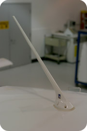 Combined Antenna |
 Stand-alone Antenna |
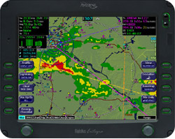 Weather |
| Page 2 |
Cirrus Monthly Proficiency Program
January – Becoming Weather Wise:
Turn your entire flight into a weather briefing
XM WEATHER FEATURES
The features available with the XM weather
services include:
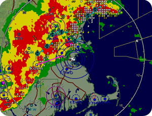
- NEXRAD Radar Returns
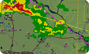
with Storm cell intensity, ground track, and datalink lightning
strike display
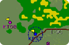
- Graphical
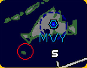
METAR
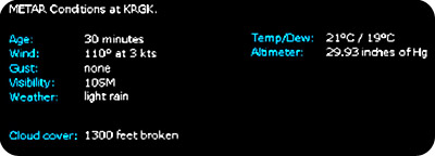
- Decoded-text METAR
| Page 3 |
Cirrus Monthly Proficiency Program
January – Becoming Weather Wise:
Turn your entire flight into a weather briefing
XM WEATHER FEATURES (continued)
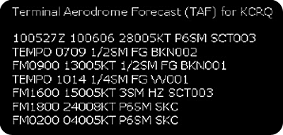
- Undecoded
Terminal Aerodrome Forecasts (TAFs)
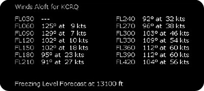
- Forecast winds aloft
and freezing levels
| Page 4 |
Cirrus Monthly Proficiency Program
January – Becoming Weather Wise:
Turn your entire flight into a weather briefing
![]()
XM WEATHER FEATURES (continued)
- AIRMET, SIGMET, and Convective SIGMET types and
boundaries
Line Color |
Type |
Label |
|
Bright Blue |
Mountain AIRMET |
MTN |
|
Dark Yellow |
IFR AIRMET |
IFR |
|
Orange |
Turbulence AIRMET |
TURB |
|
Blue |
Icing AIRMET |
ICE |
|
Dark Red |
SIGMET AIRMET |
SIG |
|
Blue Gray |
Convective SIGMET |
CSIG |
|
|
Temporary Flight Restrictions (TFRs) are
also available
|
||
| Page 5 |
Cirrus Monthly Proficiency Program
January – Becoming Weather Wise:
Turn your entire flight into a weather briefing
![]()
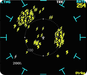
WX-500 Stormscope
Additionally, Cirrus airplanes can be equipped with the BF Goodrich WX-500
stormscope, allowing you to see the location of real-time, non-datalink
lightning strikes.
| Page 6 |
Cirrus Monthly Proficiency Program
January – Becoming Weather Wise:
Turn your entire flight into a weather briefing
![]()
A Little Preparation Goes a Long
Way…
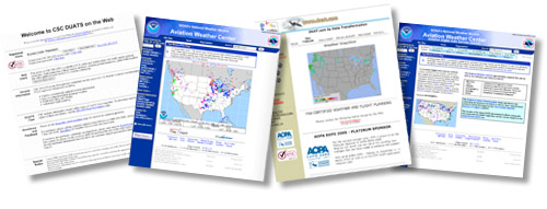
Despite the fantastic resources available
in the cockpit, pilots should always obtain thorough pre-flight
briefings before making a go/no-go decision. There are many excellent
free online resources for aviation weather information, including
the Aviation
Weather Center, the
Aviation Digital Data
Source, DUAT,
and DUATS.
|
|
There are also many subscription resources with added weather features, including the following links: |
||
As you analyze and interpret weather charts and products, remember that the Flight Service Station network is available to help you make informed decisions. By calling 1(800)WX-BRIEF, you can speak directly to a weather interpreter and receive valuable assistance as you analyze the weather. Additionally, the Flight Service briefer can provide access to Notices to Airmen (NOTAMs) and TFRs not accessible through other sources.
|
|
Important to note during your pre-flight weather brief are Pilot Reports (PIREPs) and Area Forecasts. These provide the altitude of reported and forecast cloud tops, which are important to in-flight decisions and not available through other weather products. |
||
| Page 7 |
Cirrus Monthly Proficiency Program
January – Becoming Weather Wise:
Turn your entire flight into a weather briefing
![]()
Flying by
the seat of your pants
As you use the weather information in your cockpit, follow these
simple steps to make your flights faster, easier and more efficient
while also greatly enhancing your airborne safety and situational awareness.
1. Go with
the flow!
Use the winds aloft forecast (available on the Trip page
of the MFD) to find the most favorable head- or tailwinds
for your route of flight.

Changing altitudes to take advantage of
better wind conditions
can cut significant time from a flight leg and save valuable
fuel. Remember that the winds aloft forecast is just that
-- a forecast.
Monitor the wind vector to keep an eye on the actual wind
conditions at your altitude.

|
|
Remember to follow the cruise altitude rules for your direction of flight, found in FAR 91.159 and FAR 91.179. | ||
| Page 8 |
Cirrus Monthly Proficiency Program
January – Becoming Weather Wise:
Turn your entire flight into a weather briefing
![]()
Flying by the seat of your pants (continued)
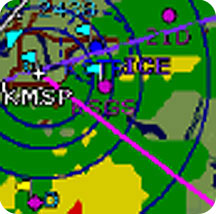
2. Ice in your veins You should also look at the forecast freezing levels for your route of flight. Take heed if the temps are near or below freezing, as this is the optimum range for ice formation. Again, this is a forecast, so reference your Outside Air Temperature (OAT) for current conditions, too.
|
 |
|
|
|
| Page 9 |
Cirrus Monthly Proficiency Program
January – Becoming Weather Wise:
Turn your entire flight into a weather briefing
![]()
Flying by the seat of your pants (continued)
2. Ice in your veins (continued)
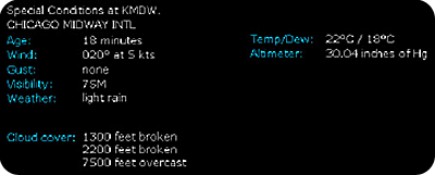
In addition to freezing temperatures, ice formation requires the presence of moisture – use the base reports from the text METARs,
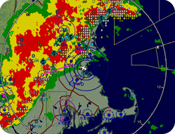
the precipitation returns from the NEXRAD returns,

and the forecast and reported tops from PIREPs and the Area Forecast to paint a picture of moisture locations. Avoid any areas where cold temperatures and moisture both exist!
|
|
Get the most current PIREPs in-flight from FSS or Flight Watch. You should obtain the Area Forecast tops during the pre-flight briefing. |
||
(For more information on icing,
click on “Contrails” under “Quick
Links.” Then click on the October issues of Pilot’s
World and Fly-Bys)
| Page 10 |
Cirrus Monthly Proficiency Program
January – Becoming Weather Wise:
Turn your entire flight into a weather briefing
![]()
Flying by the seat of your pants (continued)
3. Stormy Weather
Every pilot dreads close encounters with thunderstorms. Use
the Convective SIGMETs to pinpoint regions with conditions
favorable
to thunderstorm formation.
Line Color |
Type |
Label |
|
Bright Blue |
Mountain AIRMET |
MTN |
|
Dark Yellow |
IFR AIRMET |
IFR |
|
Orange |
Turbulence AIRMET |
TURB |
|
Blue |
Icing AIRMET |
ICE |
|
Dark Red |
SIGMET AIRMET |
SIG |
|
Blue Gray |
Convective SIGMET |
CSIG |
|
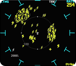
Additionally, look for areas with moderate to strong radar returns. Often, these returns will be marked with a storm intensity and ground track symbol. You can further confirm convective activity by using both the datalink and the stormscope to locate areas of lightning activity. Remember that the stormscope will provide real-time strike detection, while the datalink information may be delayed.
 |
 |
|
|
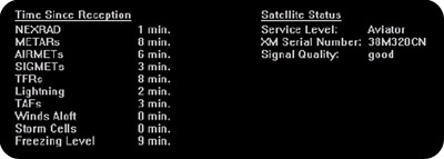
Be conservative in avoiding potential storm cells. Depending on the timeliness of satellite updates, the radar and lightning information displayed on the MFD may not represent current conditions. |
||
| Page 11 |
Cirrus Monthly Proficiency Program
January – Becoming Weather Wise:
Turn your entire flight into a weather briefing
![]()
Flying by the seat of your pants (continued)
4. Sunny Side Up
You can also use your resources to avoid IFR conditions. By monitoring
AIRMETs for IFR and Mountain Obscuration, NEXRAD returns and
METARs and TAFs, you can quickly assess conditions along your
flight path.
The METAR flags on the Map page provide a visual
overview of the conditions along your route or within a region.
This will
help you determine whether deteriorating conditions at your
destination are localized or part of a larger weather pattern.


| Page 12 |
Cirrus Monthly Proficiency Program
January – Becoming Weather Wise:
Turn your entire flight into a weather briefing
![]()
Flying by the seat of your pants (continued)
5. The Sky is Falling
If you determine that the weather is deteriorating at your destination,
along your flight path or at your alternate airport, assess
your options. If you need to divert, find an airport with METARs
and TAFs indicating conditions that exceed your personal minimums.
(Click here for a Personal Minimums Worksheet).
|
|
During flight, monitor the METARs and TAFs for your destination and alternate. If they don’t follow the trends that you expected after completing your pre-flight briefing, consider calling Flight Watch on 122.0. They can provide information that may help you determine the reason conditions are changing. |
||
6.
Under Pressure
During your preflight briefing, you may have identified one
or more frontal systems that could influence your flight path.
While
you don’t have a direct depiction of those fronts in
the airplane, you can still keep an eye on where they are located
and how they are developing.
Precipitation is an obvious indicator of frontal location.
If there is no precip, the altimeter settings at airports in
the
path of the front will indicate location. Expect the local
pressure to drop as a warm front passes, and to rise with a
cold front.
| Page 13 |
Cirrus Monthly Proficiency Program
January – Becoming Weather Wise:
Turn your entire flight into a weather briefing
![]()
Weather Reports 101
We all remember trying to memorize facts and figures for weather
products during our pilot training. While you may have forgotten
a few things since then, there are some important details to
keep in mind as you use in-flight weather resources. Click
here to see a list of important facts about your weather resources.
|
|
Share
the Wealth! |
||
| Page 14 |
Cirrus Monthly Proficiency Program
January – Becoming Weather Wise:
Turn your entire flight into a weather briefing
![]()
NTSB ACCIDENT REPORT
Now that you’ve learned about the
weather resources available to you, click on the following link
to review this NTSB Accident
Report:
Analyze the accident. Think about how the pilot, his use of in-flight resources and his weather awareness and knowledge contributed to the accident.
- What systems and features available on a Cirrus airplane could have helped prevent this accident?
- How did the pilot’s actions and decisions affect safety with regard to weather?
- What weather-based decisions might have lead to a safer outcome?
- Why might a ground-based preflight weather briefing have been inadequate in this scenario?
| Page 15 |
Cirrus Monthly Proficiency Program
January – Becoming Weather Wise:
Turn your entire flight into a weather briefing
![]()
To try your hand at making wise weather decisions, click on the Pilot's World Challenge below

![]()
| Page 16 |
Cirrus Monthly Proficiency Program
January – Becoming Weather Wise:
Turn your entire flight into a weather briefing
![]()
Objective:
This month’s flight segment requires
both ground and in-flight activities. The objective is to reinforce
good weather
decision making both during preflight and enroute using all resources available to you, including Flight Service, Flight
Watch, computer-based weather products, and in-flight weather
resources.
Complete the following weather management exercises by incorporating them into your flight activities. Ideally, you will complete these exercises with a CSIP instructor on-board to help critique and asses your performance. Always maintain situational awareness and never compromise the safety of yourself or others.
Flight activity items to complete:
- Complete a Personal Weather Minimums assessment
- Obtain a thorough pre-flight weather briefing
- Make an appropriate go/no-go decision for the flight
- During flight, use all available resources to monitor the weather:
- Compare the weather from the briefing to the weather observed in the air
- Observe the in-flight indications of major systems and fronts
- Use the in-flight resources to monitor local weather phenomena
- Contact Flight Watch and request a route briefing
- Submit a Pilot Report
- Practice making a weather-caused diversion while using your resources to determine a safe alternate airport
![]() For
a Printable PDF version of this information, CLICK HERE.
For
a Printable PDF version of this information, CLICK HERE.
![]()
| Page 17 |
Cirrus Monthly Proficiency Program
January – Becoming Weather Wise:
Turn your entire flight into a weather briefing
![]()
You will successfully complete the January CIRRUS Monthly Pilot
Proficiency program when you have gained a thorough understanding
of pre-flight and in-flight Weather Resources. Additionally,
you will understand how to analyze and interpret the information
available in your Cirrus airplane cockpit and will make appropriate
in-flight decisions to minimize and avoid weather-related
risks while operating within your personal minimums.
Thanks for visiting Cirrus Pilot’s World and taking the January Monthly Proficiency Program. We hope you enjoyed the experience and that it has helped to increase your awareness, skill and proficiency in safely flying your Cirrus SRV, SR20 or SR22. Please take a moment to give us your feedback about this month’s course. Your suggestions will help us provide you with courses to improve your all-around flying safety and enjoyment Write to us at: pilotsworld@cirrusdesign.com. See you next month!
|
| Page 18 |

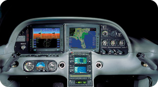 Imagine how helpful it would be if
you could look at real-time weather reports and forecasts
during your flight. With XM weather and Cirrus Design,
your wish is reality!